Zip Code Radius Tool: Calculate Distances Accurately
The zip code radius tool provides a practical, professional way to map service areas and calculate distances for business planning and market analysis.
Users can define a center point on the map or enter an address to run a radius search that returns a structured list of zip codes within the boundary. Settings allow miles or kilometers and enforce a maximum span of 625 miles (1000 km) to keep responses reliable and fast.
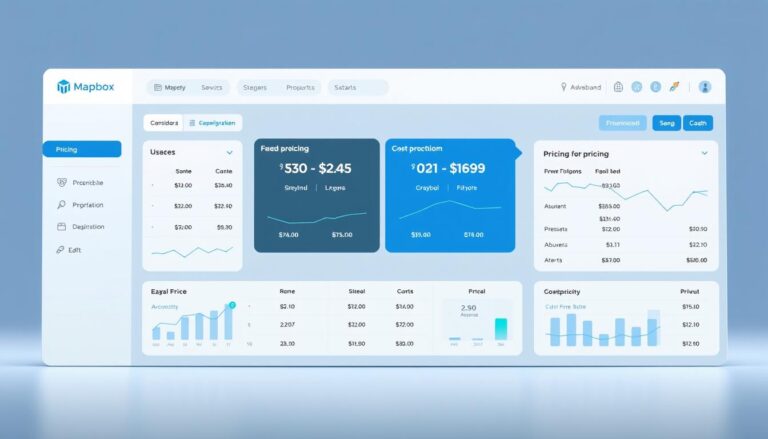
The interface supports Full Screen, Center Marker, ZIP labels, county borders, and a Combined CSV output that lists ZIP, State, County, City, TimeZone, and Distance. Results appear after a short delay and hovering reveals each code on the map, helping teams validate coverage quickly.
Key Takeaways
- Decision-grade output: CSV-ready list for logistics and sales planning.
- Configurable units: Miles or kilometers with a 625-mile cap for stability.
- Interactive map features: Visualize boundaries and labels for verification.
- Refinement options: Exclude PO Boxes and apply state filters to focus results.
- Operational use: Repeatable workflows for territory scoping and direct mail.
What is a ZIP code radius and why it matters for U.S. businesses
A zip code radius defines the set of postal areas located inside a circle measured in miles from a central point. This circle is drawn on a map to show which zip codes fall within a service area or coverage zone.
For business planning and market analysis, the value is practical and measurable. Teams use the circle to size territories, plan delivery zones, and estimate demand using standardized geographic units.
Operational benefits include faster territory sizing, consistent routing comparisons, and clearer SLAs when distances in miles back delivery promises. Filters such as state limits and exclusion of PO Boxes streamline the list of codes within the area to match eligibility rules.
“Defining a code radius produces comparable metrics across markets for benchmarking store performance and delivery coverage.”
The exportable CSV output lets analysts integrate results into sales, logistics, and finance workflows. When teams need to find zip codes within a given distance, the radius search delivers repeatable, decision-grade lists for campaigns and field operations.
How a zip code radius tool works under the hood
Establishing a precise center requires reliable geocoding and clear selection methods.
Geocoding methods: forward, reverse, and choosing a central point
Forward geocoding converts a five-digit entry into latitude/longitude for distance computations.
Reverse geocoding maps a clicked map point or the device location back to the nearest postal identifier.
The central point may be set by entering a ZIP, tapping the map, or using browser geolocation. Once set, the system computes distances from that central point.
Distance calculations with the Haversine formula
Great-circle distances use the Haversine formula with Earth’s radius ≈ 3958.8 miles. This yields mile-accurate results suitable for service-area thresholds and delivery planning.
Implementations often prefilter candidates by a bounding box to reduce processing time, then apply Haversine filtering in code for final selection.
Data sources and boundaries: USPS ZIPs vs Census ZCTAs (2023 TIGER/Line)
USPS identifiers represent delivery routes; Census ZCTAs are area approximations. Using 2023 TIGER/Line ZCTAs lets analysts align lists with Census demographics.
Method choice matters: a code radius search can return USPS-like lists or ZCTA-based lists. Documenting the data source and using batching or caching reduces request time and throttling risk.
- Forward/reverse geocoding for center selection
- Haversine in miles for distance accuracy
- Bounding-box prefiltering to improve performance
- ZCTA centers for Census-aligned results
Step-by-step: Run a radius search and find ZIP codes within miles
Initiate a radius search by entering a five-digit postal entry or placing a point on the map. Set the distance in miles or kilometers, observing the platform cap (625 miles / 1000 km). The map auto-fits to the drawn circle to provide clear geographic context.
Search by ZIP code
Enter a specific zip code, choose miles or kilometers, and set the desired span. The system fits the map to the circle and starts computing results.
Search by map
Click map to place a center point. The interface draws the radius around that point and returns postal areas inside the buffer.
Use current location
Select the current location option to trigger browser geolocation and reverse geocoding. Permission prompts and fallbacks are handled for denied, unavailable, or timed-out positions.
- Results panel: Shows “ZIP Codes within X miles of [ZIP]” and a count of zip codes found.
- Hover actions: Hover over markers to reveal each postal identifier and distance from the center.
- Export: Download a combined CSV containing codes, distance, and geography for CRM or routing imports.
Use Full Screen and Clear Map between runs. Add labels, markers, and boundaries to verify the specific zip captured by the radius location before exporting results.
Interactive map tools and options that speed up your workflow
Interactive map controls accelerate setup and let teams verify coverage in minutes. The interface groups visualization and export options so analysts can move from audit to delivery planning without friction.
Center marker, ZIP labels, and ZIP markers for clear visualization
Enable the center marker and postal labels to show the origin point and nearby identifiers. ZIP markers reveal distances and support quick visual checks of codes found.
Show ZIP boundaries and US county borders for precise areas
Toggle boundaries and county lines to align results with administrative limits. This helps validate service eligibility and tax or compliance edges.
Filter by state and exclude PO Boxes to refine codes found
Apply a state filter and PO Box exclusion to reduce noise and focus on deliverable areas. Counts react instantly when filters change, improving accuracy for downstream reports.
Export, full screen, and performance considerations
- Combined CSV export: One-click download of zip codes within the buffer with ZIP, State, County, City, TimeZone, and Distance.
- Full Screen & Clear Map: Expand the map workspace and reset layers for rapid iteration.
- Performance note: Test moderate spans first; very large buffers may slow browser-based processing.
Business planning with ZIP codes by distance
Business planners use distance-based postal lists to size service areas and set operational boundaries.
Define service areas, delivery zones, and sales territories
Establish service areas in miles to ensure delivery promises are feasible. Teams combine multiple buffers and apply state filters to form sales territories that match legal and operational limits.
Market analysis and direct mail targeting by ZIP codes within specific miles
Marketers build targeted mail files from lists of zip codes within specific miles to measure response by geography. Exportable lists support CRM segmentation and campaign reporting.
Compare population at each buffer level and overlay competitor coverage to identify white space. Analysts use ZCTA outputs from 2023 TIGER/Line to align demand estimates with Census population and income data.
Real estate research, commuting times, and relocation planning
Use mile-based buffers as a preliminary commuting proxy. For final decisions, supplement with network travel-time analysis.
| Use case | Primary output | Recommended method | Business benefit |
|---|---|---|---|
| Delivery coverage | List of postal areas within miles | 5-digit USPS or ZCTA | Operational SLA feasibility |
| Direct mail | Targeted mail file | Filter by state & exclude PO Boxes | Higher match and response rates |
| Site selection | Population & overlap maps | ZCTA with demographic overlay | Demand benchmarking |
Accuracy, limits, and best practices for reliable results
Distance accuracy often depends on local address density and the underlying geographic dataset. In dense urban markets, measurements commonly reach within 0.1 miles of true distance. Rural and frontier areas show larger variance because centroids and delivery routes are sparse.
System caps and performance
Adhere to the platform cap (625 miles / 1000 km) to avoid long processing times and browser instability. Large buffers produce many results and can trigger client-side slowdowns or service throttling.
Troubleshooting and data choices
Validate edge postal areas against visible boundaries and county lines to reduce inclusion errors. Use ZCTA-based lists for population and income analysis and USPS-derived lists for delivery planning.
If an input is invalid or a geocoder throttles requests, retry with smaller queries or batch multiple searches. Cache frequent centers and distances to cut time and repeated service calls.
Quick checklist
- Confirm units (miles vs kilometers) — display only, not accuracy
- Apply state filters and exclude PO Boxes before export
- Document data source and date for auditability
Advanced use: zip code radius tool in integrated workflows
Combining several circles produces a practical approximation of complex coverage areas. Teams can run multiple searches from different central points, export each Combined CSV, and merge results for a single overview.
Multiple centers and Google Maps-style workflows
Analysts place origins in a familiar map interface, run small tests, then scale. This mirrors common Google Maps steps and eases user adoption.
Export, merge, and filter by population
After export, deduplicate overlapping codes, add metadata (center coordinates, miles, data source, run date), and load into BI systems. When ZCTA population filters are applied, teams prioritize high-demand areas for targeting.
- Repeatable pipeline: run, export, dedupe, and import.
- Governance: capture metadata with every export.
- Template settings: save boundaries, labels, and PO Box exclusions for consistent reports.
| Action | Output | Benefit |
|---|---|---|
| Multi-center searches | Merged CSV list | Comprehensive coverage map |
| Population filter | ZCTA-based subset | Prioritized campaigns |
| State filter + dedupe | Balanced territory file | Operational parity across regions |
Conclusion
Reliable, repeatable outputs let managers convert geographic queries into immediate operational actions.
The platform delivers exportable lists of zip codes within a chosen mile span for direct use in planning and reporting. Visual checks on the map let teams click map points and refine the center before export.
Document the method—USPS-style versus 2023 TIGER/Line ZCTA center-in—when you report coverage. That practice preserves auditability and aligns results with demographic or delivery needs.
For a simple workflow: run a radius search, export the Combined CSV, and import the list into planning systems. Small refinements such as state filters, boundary overlays, and PO Box exclusions improve list quality with minimal effort.
Standardize the configuration, use moderate spans, and cache frequent centers to keep performance predictable. Precise radius zip coverage improves budgeting, targeting, and service deployment across sales, delivery, and site selection use cases.
FAQ
What is a ZIP code radius and why does it matter for U.S. businesses?
A ZIP code radius defines a circular area around a central postal ZIP used to group nearby locations. For businesses, it supports service-area definition, delivery planning, direct-mail targeting, and market sizing by quickly identifying nearby postal regions and the population they contain.
How does a ZIP radius solution determine distances and locations?
The system geocodes the central postal area via forward or reverse methods to obtain latitude/longitude, then applies great-circle calculations such as the Haversine formula to deliver mile-accurate distances. Reliable boundary data sources, like USPS ZIP listings or Census ZCTAs (TIGER/Line), ensure consistent area definitions.
What steps are involved in running a radius search to find ZIPs within a set number of miles?
Enter a five-digit postal region or click a map to set a center point, choose miles or kilometers, and set the desired distance. The platform performs geocoding, computes distances from the center, and returns all postal areas whose centroids or boundaries fall within the circle. Results can be filtered and exported as needed.
Which interactive map features improve workflow and visualization?
Useful features include a center marker with labels, visible postal markers, optional boundary overlays for ZIPs and county lines, state filters, and the ability to exclude PO Boxes. Export options (CSV), full-screen mode, and performance tuning for large searches accelerate analysis.
How can businesses use radius-search outputs for planning and analysis?
Outputs support defining service areas and delivery zones, designing sales territories, selecting retail sites, and refining direct-mail lists. Combining radius results with demographic or population-level filters enables market analysis, competitor mapping, and logistics optimization.
What accuracy limits and best practices should users expect?
Accuracy is typically high in dense urban areas where centroid and boundary data are precise; remote regions may require approximation. Observe platform radius caps and browser constraints when running large searches. To reduce errors, validate input postal regions, handle API throttling, and use up-to-date boundary datasets.
How can the radius capability integrate with existing workflows and exports?
The feature supports Google Maps–style interactions, multiple center points, and combining circles for complex service footprints. Results export to CSV for use in CRM, GIS, or logistics systems. Adding population and demographic filters creates ready-to-use lists for sales and planning teams.